

Rain has already started falling in the Columbia area, and more precipitation and powerful winds are forecast to lash the Midlands Monday.
Widespread rainfall, which could be heavy at times, is expected to continue through Monday night, the National Weather Service said in a morning briefing.
Scattered to numerous showers and thunderstorms are likely to increase in the afternoon and will remain a threat into the evening, according to the briefing.
Up to 3 or 4 inches of rain could fall in Columbia, according to the National Weather Service, as the forecast shows there’s 100% chance of showers Monday. Localized amounts in other areas of the Midlands could be higher.
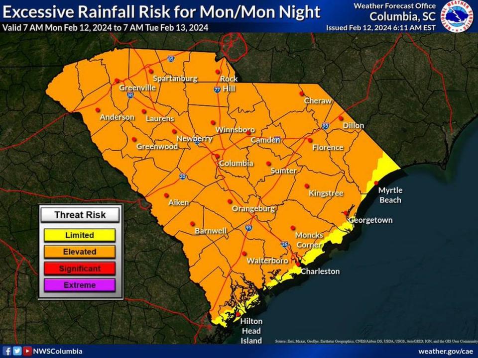
As a result, a flood watch was issued for nearly all of the Midlands — including Richland and Lexington counties — and is in effect through midnight Tuesday, the National Weather Service said. Low lying areas, and those with poor drainage, are at the greatest risk of flooding, according to the briefing.
Additionally, a lake wind advisory was issued for the same area of South Carolina, according to the National Weather Service. It goes in effect at 7 p.m. Monday and runs through 1 p.m. Tuesday, the National Weather Service said. Powerful wind gusts could reach 40 mph, according to the briefing.
The National Weather Service said the threat of tornadoes forming in the thunderstorms is low, but they are possible.
Powerful winds and tornadoes could cause considerable damage to trees and branches, in addition to mobile homes, roofs and outbuildings. Vehicles would also be under siege in the case of a tornado.
Damage to trees and branches creates the possibility of downed power lines and outages.

While the rain and wind are forecast to affect all of the Midlands, the area around and north of Interstate 20 are expected to feel the greatest impacts, according to the National Weather Service.
Heavy rain could lead to water on the roads, and drivers are urged to use caution.
“If you must drive, remember these tips to keep you (and others) safe,” the South Carolina Department of Public Safety said. “Wipers on, headlights on, slow down, increase your following distance.”
After the thunderstorms move out of the area, the rain is expected to stop and the forecast for the rest of the week is dry. Tuesday is expected to still be breezy, with 11 to 21 mph winds and potential 30-plus mph gusts in the forecast.
By Wednesday, the winds are predicted to die down and conditions are forecast to be calm with temperatures in the mid 60s possible to the weekend.